mail_outline sales@mediastorehouse.com
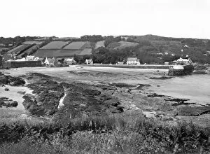
The Harbour at St Mawes, Cornwall, 1924A GWR publicity view of the harbour at St Mawes in Cornwall in 1924, showing a family walking along the quay
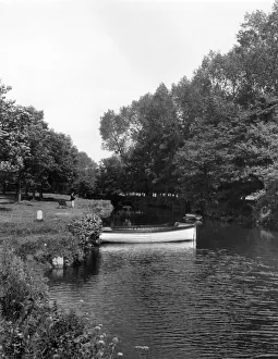
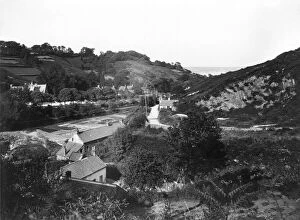
One the River Fowey at Lostwithiel, Cornwall, July 1927A GWR publicity image of the River Fowey at Lostwithiel in Cornwall, taken July 1927. A rowing boat is moored up along the bank
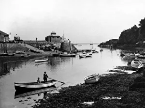
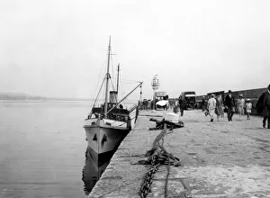
Looe Ferry, Cornwall, March 1924A GWR publicity view of the ferry landing stage at the town of Looe in Cornwall, March 1924. Small boats line the shore in the foreground while people are walking along the slipway by the harbour
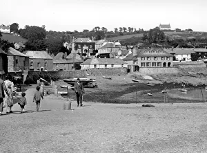
Looe, Cornwall, March 1924A GWR publicity view of the coastal town of Looe in Cornwall, taken in March 1924 and looking upstream. The church tower of The Parish of Saint Nicholas is in the bottom right of the image
Scilly Isle Flower Traffic, Cornwall, August 1928A GWR publicity image taken on one of the Scilly Isles off the coast of Cornwall in August 1928, showing boats at the harbour loading flowers for shipping to the mainland
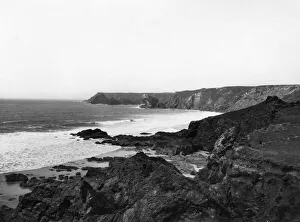
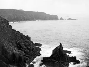
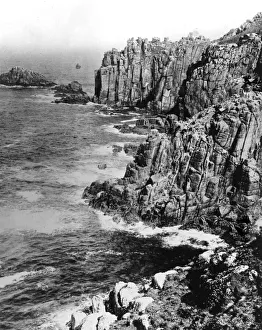
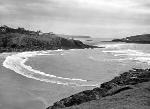
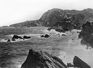
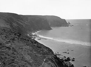
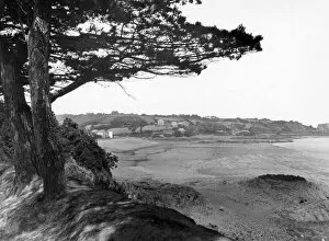
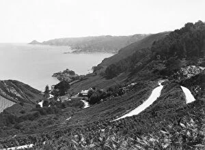
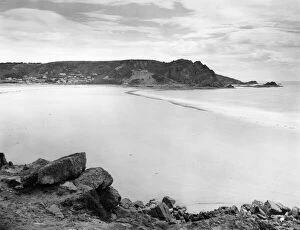
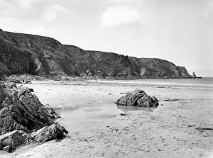
The Coastline Between Lizard and Kynance Cove, Cornwall, July 1924A GWR publicity view of the coast between Lizard and Kynance Cove in Cornwall, July 1924, showing the dramatic cliffs and rolling waves crashing onto rocks
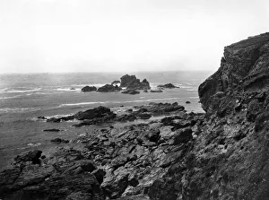
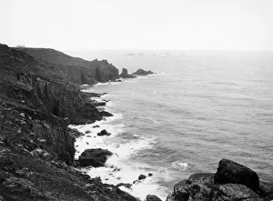
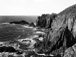
Between Lizard and Kynance Cove, Cornwall, July 1923A GWR publicity view of the coastline between Lizard & Kynance Cove in Cornwall, July 1923, showing the dramatic cliffs, rock formations and crashing waves
The Coast Between Lizard & Kynance Cove, Cornwall, July 1923A GWR publicity view of the coastline between Lizard & Kynance Cove in Cornwall, July 1923, showing the dramatic cliffs and crashing waves
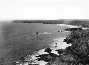
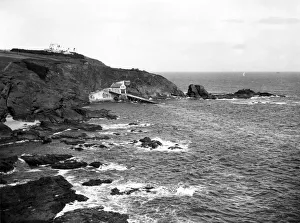
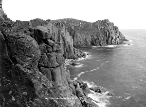
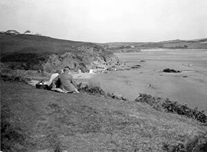
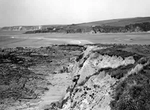
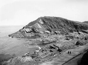
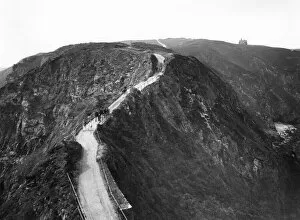
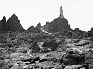
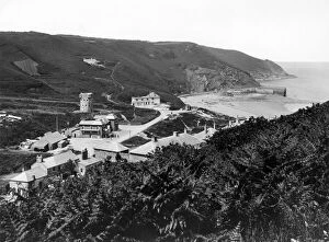
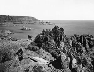
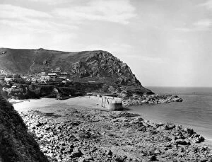
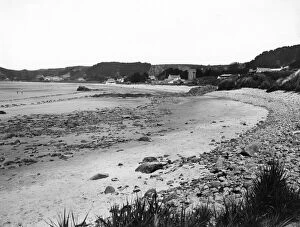
Lizard Point, Cornwall, July 1923A GWR publicity view of Lizard Point in Cornwall, July 1923, showing the most southerly part of the UK and the old lifeboat station and its slipway
Lands End and Longships Lighthouse, Cornwall, c. 1928A GWR publicity view of the northern side of Lands End, Cornwall, c.1928, showing Longships Lighthouse in the distance
Lands End, Cornwall, c. 1928A GWR publicity view of the north side of Lands End, Cornwall, c.1928, showing the rugged coastal cliffs
Cliffs at Lands End, Cornwall, 2nd February 1925A GWR publicity view of the cliffs below the First and Last House at Lands End, Cornwall, 2nd February 1925
Cliffs at Lands End, Cornwall, 1924A GWR publicity view of the cliffs at Lands End in Cornwall, 1924. These cliffs lie below the First and Last House
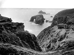
Lands End, View towards Longships, February 1924A GWR publicity view of the view towards Longships Lighthouse at Lands End, Cornwall, February 1924. The natural archway can be seen in the rocks closer to the shore
Lions Den, Lands End, Cornwall, February 1924A GWR publicity view of the Lions Den at Lands End in Cornwall. Taken around February 1924 this image shows the rugged coastal cliffs at Lands End, looking towards Enys Dodnan Arch
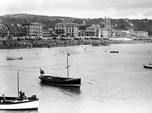
East Beach, Teignmouth, Devon, c. 1925A GWR publicity view of the seaside at Teignmouth, c.1925. This image shows the east or Town Beach and was probably taken from the Grand Pier
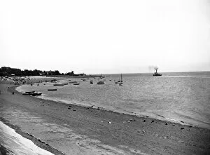
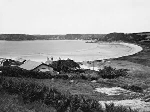
Exmouth Beach, Devon, July 1923A GWR publicity view of Exmouth Beach, looking south east along the coast of Devon, in July 1923. The water is full of small boats and people are gathered towards the far end of the beach
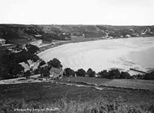
Bigbury-on-Sea & Burgh Island from Challaborough Cove, August 1928A GWR publicity view of Bigbury-on-Sea & Burgh Island on the southern coast of Devon. Taken from Challaborough Cove, just north of Bigbury-on-Sea, in August 1928
Bigbury & Bantham Sands, Devon, August 1928A GWR publicity view of Bigbury & Bantham Sands on the southern coast of Devon, August 1928. A couple are having a picnic on the top of the cliffs, looking down at holidaymakers on the beach below
Bantham & Bigbury Sands, Devon, August 1928A GWR publicity view of Bantham & Bigbury Sands in Devon, August 1928, showing the beach at low tide with the coastline in the distance
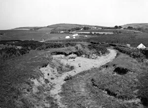
Bantham, Devon, August 1928A GWR publicity view of Bantham on the south Devon coast, August 1928, showing a number of tents nestled among the grass covered dunes
Cliffs at Ilfracombe, DevonA GWR publicity view of the cliffs near Ilfracombe in Devon in c.1920s-1930s. The Chapel of St Nicholas can be seen on the top of the cliff towards the right of the image
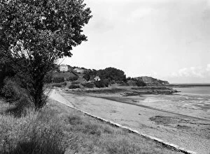
Capstone Hill, Ilfracombe, Devon, 1929A GWR publicity view of Capstone Hill and Wildersmouth Cove at Ilfracombe in Devon, August 1929. The Promenade and the Capstone Parade can be seen hugging the shoreline in this image
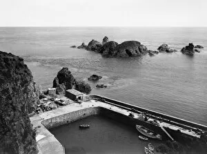
Creux Harbour, Sark, 1925A GWR publicity view of Creux Harbour on the eastern coast of Sark in the Channel Islands, 1925. Small boats are moored up within the harbour walls
La Coupee, Sark, 1925A GWR publicity view of La Coupee on Sark in the Channel Islands, 1925. This ridge links Great Sark in the north of the island with Little Sark to the south
St Aubins Bay, Jersey, June 1925A GWR publicity view of St Aubins Bay on the southern coast of Jersey in the Channel Islands, in early summer 1925. The large bay can be seen to sweep around into the distance in this image
L Etacq, Jersey, June 1925A GWR publicity view of L Etacq, on the north-western side of Jersey in the Channel Islands, June 1925, showing the beach and the bay with a few people pottering about on the sand
Plemont, Jersey, June 1925A GWR Publicity view of the cliffs and beach at Plemont on the north coast of Jersey in the Channel Islands. This view shows the cliffs towards the prehistoric site, La Cotte a la Chevre in June 1925
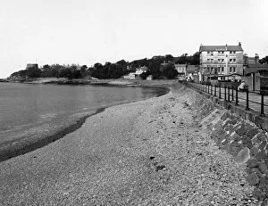
St Catherines Bay, Jersey, June 1925A GWR publicity view of St Catherines Bay on the north-eastern coast of Jersey in the Channel Islands, June 1925. This image shows the beach on a quiet day at low tide
St Catherines Bay, Jersey, c. 1920sA GWR publicity view of St Catherines Bay on the north-eastern coast of Jersey in the Channel Islands, c.1920s. This image shows the beach on a quiet day with the St Catherine Breakwater on the right
Rozel Bay, Jersey, June 1925A GWR publicity view of the village of Rozel and its bay on the northern coast of Jersey in the Channel Islands, June 1925
La Corbiere, Jersey, June 1925A GWR publicity view of the rocky island La Corbiere on the extreme south west side of Jersey in the Channel Islands, June 1925
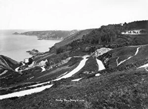
Bouley Bay, Jersey, June 1925A GWR publicity view of Bouley Bay on the north coast of Jersey in the Channel Islands. This image was taken up on the hillside looking down into the bay in June 1925
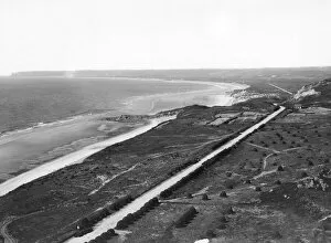
St Ouens Bay, Jersey, June 1925A GWR publicity view of St Ouens Bay on the north-western coast of Jersey in the Channel Islands, June 1925, showing the long stretch of sand and coastal road
La Greve de Lecq, Jersey, June 1925A GWR publicity view of La Greve de Lecq on the northern coast of Jersey in the Channel Islands, June 1925. This image shows the village and the beach
St Brelades Bay, Jersey, c. 1920sA GWR publicity view of St Brelades Bay on the southern coast of Jersey in the Channel Islands, c.1920s. The image was taken from the cliff top looking down into the bay
Bouley Bay, Jersey, c. 1920sA GWR publicity view of Bouley Bay on the north coast of Jersey in the Channel Islands. This image was taken up on the hillside looking down into the bay, c.1920s
Corbiere Coast, Jersey, June 1925A GWR publicity view of the coastline at La Corbiere on the extreme south west side of Jersey in the Channel Islands, June 1925
Grouville Valley, Jersey, June 1925A GWR publicity view of Grouville Valley off the eastern coast of Jersey in the Channel Islands, June 1925. Among the villages in this area lies Gorey
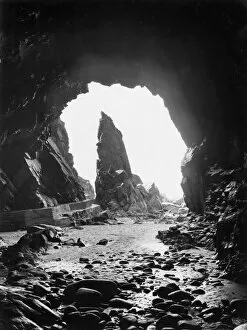
Plemont Caves, Jersey, June 1925A GWR Publicity view of Plemont Caves on the north side of Jersey in the Channel Islands, June 1925. This dramatic view shows the pinnacle of rock near the prehistoric site, La Cotte a la Chevre
Jersey, Channel Islands, c. 1920sA GWR publicity view of one of the bays on the coast of Jersey in the Channel Islands, c.1920s. The GWR ran shipping services to the Channel Islands and other locations from the 1870s to the 1940s
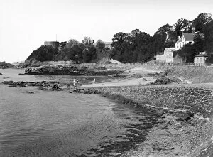
La Collette, St Helier, Jersey, June 1925A GWR publicity view of La Collette at the southernmost end of St Helier on Jersey in the Channel Islands, June 1925. In the 1920s La Collette was a popular place for taking a walk along
St Johns Bay, Jersey, c. 1925A GWR publicity view of Bonne Nuit Pier and the bay near St John on the northern coast of Jersey in the Channel Islands, c.1925
La Collette, Jersey, June 1925A GWR publicity view of La Collette on the southernmost outskirts of St Helier on Jersey in the Channel Islands, June 1925
St Brelades Beach, Jersey, June 1925A GWR publicity view of St Brelades Beach on Jersey, in the Channel Islands, June 1925. People are strolling along the sand with St Brelade in the distance
St Brelades Bay, Jersey, June 1925A GWR Publicity view of St Brelades Bay on Jersey in the Channel Islands, June 1925, showing a few people walking along the beach at low tide
Plemont, Jersey, c. 1920sA GWR Publicity view of Plemont Beach on the north side of Jersey in the Channel Islands, c.1920s. This view shows the cliffs towards the prehistoric site, La Cotte a la Chevre
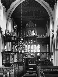
Crowcombe Church (interior), SomersetA GWR Publicity interior view of The Church of the Holy Ghost, Crowcombe in the Quantock Hills of Somerset, c.1920s. The church is Grade I listed and lies on the site of a Saxon church