mail_outline sales@mediastorehouse.com
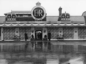
Royal Tour of West Country - Truro Station Decorations, 9th May 1956This image shows Truro station decorated in preparation for the Royal Tour of West Country, 9th May 1956
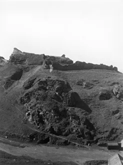
Tintagel Castle Looking Uphill, August 1927A GWR publicity view of the ruins of Tintagel Castle on the rugged northern coast of Cornwall. This image looks uphill towards the medieval castle and was taken in August 1927
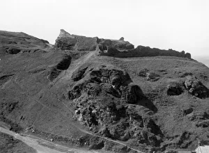
Tintagel Castle, Cornwall, August 1927A GWR publicity view of the ruins of Tintagel Castle on the rugged northern coast of Cornwall. This image looks uphill towards the medieval castle and was taken in August 1927
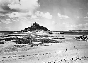
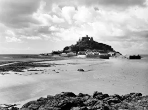
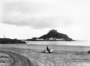
St Michaels Mount from Marazion Beach, August 1935A GWR publicity view of St Michaels Mount in Cornwall from the sandy beach at Marazion in August 1935. The tide is low so the causeway is visible and people are out on the beach
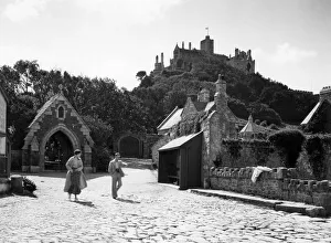
On the Mount at St Michaels Mount, Cornwall, August 1935A GWR publicity view of holidaymakers on St Michaels Mount in Cornwall, taken on a sunny day in August 1935
St Michaels Mount at Low Tide, August 1935A GWR publicity image of the Cornish landmark St Michaels Mount at low tide, August 1935. Some people are walking along the causeway between the castle and Marazion Beach
St Michaels Mount at High Tide, August 1928A GWR publicity image of the Cornish landmark St Michaels Mount at high tide, August 1928. The causeway linking Marazion to the castle is nowhere to be seen
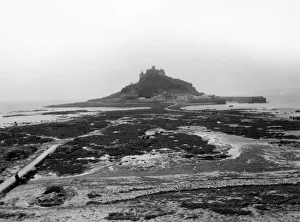
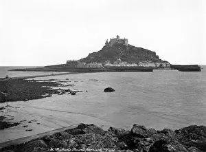
St Michaels Mount at Low Tide, August 1928A GWR publicity image of the Cornish landmark St Michaels Mount at low tide, August 1928. A ribbon of people are walking along the causeway between the castle and Marazion
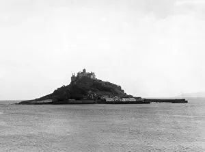
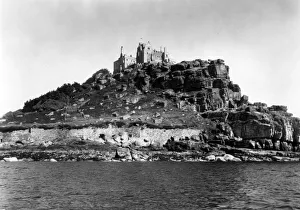
St Michaels Mount, Cornwall, August 1928A GWR publicity view of St Michaels Mount in Cornwall, taken from the sea in August 1928. The image shows the craggy Cornish rocks of the coastline and the castle at the top
St Michaels Mount from the beachA GWR publicity view of St Michaels Mount in Cornwall taken from the beach, showing the causeway at low tide and the castle
St Michaels Mount from Marazion BeachA GWR publicity view of St Michaels Mount in Cornwall, taken from the beach at Marazion. The causeway is visible from the beach with a man and a small boat on the sand
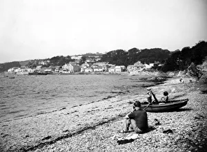
Across the Bay at St Mawes, Cornwall, September 1937A GWR publicity view of the village of St Mawes in Cornwall taken from across the bay in September 1937. A family with a small boat is enjoying themselves on the shoreline
The Promenade at St Mawes, Cornwall, September 1937A GWR publicity view of people walking along the promenade in the sunshine at St Mawes in Cornwall, September 1937
Along the Quay at St Mawes, Cornwall, September 1930A GWR publicity view taken along the quay at St Mawes in Cornwall, September 1930, with palm trees and thatched cottages lining the sea road
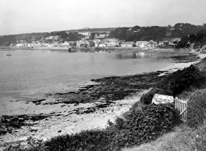
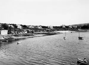
St Mawes from across the bay, September 1930A GWR publicity view of the village of St Mawes in Cornwall taken in September 1930 from across the bay
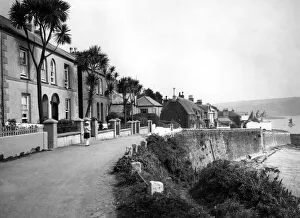
St Mawes Village, Cornwall, September 1930A GWR publicity view of the village of St Mawes in Cornwall, taken in September 1930. A group of people are walking up a hill lined with white washed cottages on the side
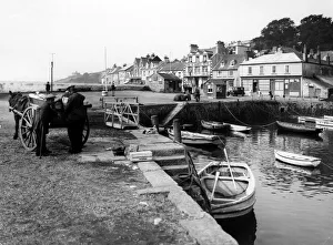
St Mawes Harbour, Cornwall, September 1930A GWR publicity view of St Mawes harbour, Cornwall, in September 1930. The image shows a number of small boats safely moored up in the harbour with people loading up a horse and cart
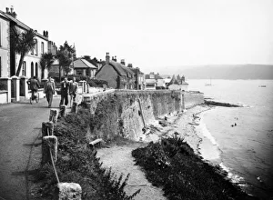
St Mawes from the Castle, Cornwall, August 1928A GWR publicity view of the coastal village of St Mawes in Cornwall, taken in August 1928 from St Mawes Castle
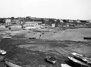
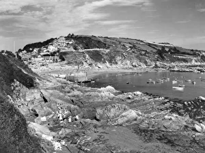
St Mawes Harbour, Cornwall, August 1928A GWR publicity view of the village of St Mawes in Cornwall in August 1928, showing a number of small boats moored up in the harbour
St Mawes, Cornwall, August 1928A GWR publicity view of Summers Beach at the village of St Mawes in Cornwall in August 1928. The image shows several small boats moored up in the harbour
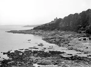
St Mawes Castle, Cornwall, 1924A GWR publicity view of a cove near the village of St Mawes in Cornwall, 1924. Henry VIIIs artillery fort St Mawes Castle can be seen behind a line of trees
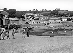
The Harbour at St Mawes, Cornwall, 1924A GWR publicity view of the harbour at St Mawes in Cornwall in 1924, showing a family walking along the quay
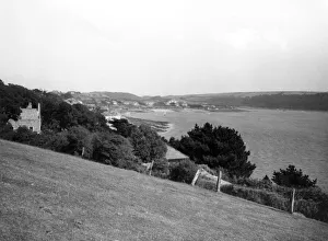
Lostwithiel Valley from Restormel Castle, Cornwall, May 1949A GWR publicity view of Lostwithiel Valley from Restormel Castle in Cornwall, May 1949. Restormel Castle lies outside the town of Lostwithiel with views over the wooded valley and the River Fowey
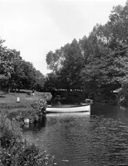
One the River Fowey at Lostwithiel, Cornwall, July 1927A GWR publicity image of the River Fowey at Lostwithiel in Cornwall, taken July 1927. A rowing boat is moored up along the bank
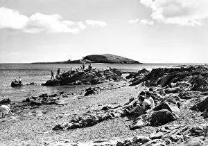
Looe Beach and Island, Cornwall, August 1951A GWR publicity view of East Looe Beach and St Georges Island, Cornwall, August 1951. Holidaymakers are lounging on the beach
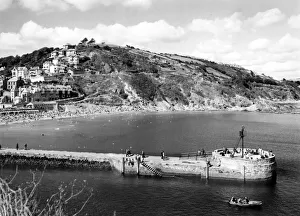
Looe, Banjo Pier and Beach, Cornwall, August 1951A GWR publicity view of the Banjo Pier at Looe and East Looe Beach in Cornwall, August 1951. The pier was the first of its type built in the world
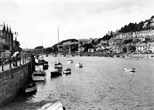
Looe Harbour, Cornwall, August 1951A GWR publicity view of Looe Harbour and Bridge in Cornwall, August 1951, showing small boats at the quay and harbour lining the banks of the river
Looe Beach, Cornwall, August 1951A GWR publicity view of East Looe Beach and the coastal town of Looe in Cornwall, August 1951. This image was probably taken from a boat on the water looking back to the shore
Banjo Quay and Beach at Looe, Cornwall, August 1951A GWR publicity view of the Banjo Pier at Looe in Cornwall, August 1951. The pier was the first of its type built in the world and is so called because it looks like a banjo from above
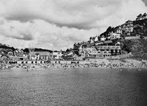
East Looe Beach, Cornwall, August 1951A GWR publicity view of East Looe Beach in Cornwall, August 1951, showing holidaymakers covering the sand. Couples and families are lounging in deckchairs enjoying the sunshine
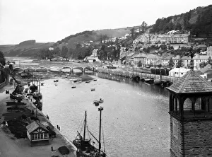
Looe Harbour and Bridge, Cornwall, August 1951A GWR publicity view of Looe harbour and bridge, Cornwall, August 1951. The stone bridge was built in 1853 and connects the western and eastern sides of the town
The Banjo Pier at Looe, Cornwall, August 1936A GWR publicity view of the Banjo Pier at Looe in Cornwall, August 1936. The pier was the first of its type built in the world and is so called because it looks like a banjo from above
Looe Bay, Cornwall, August 1936A GWR publicity view of the coastal town of Looe and Looe Bay, Cornwall, August 1936. This image shows the Banjo Pier at the Looe Estuary
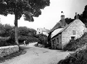
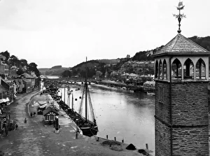
Looe Quay, Cornwall, c. 1930A GWR publicity view of the coastal town of Looe in Cornwall, taken looking upstream in c.1930. The church tower of The Parish of Saint Nicholas is in the bottom right of the image
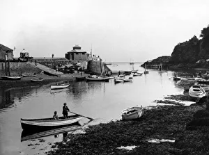
Looe Ferry, Cornwall, March 1924A GWR publicity view of the ferry landing stage at the town of Looe in Cornwall, March 1924. Small boats line the shore in the foreground while people are walking along the slipway by the harbour
Looe, Cornwall, March 1924A GWR publicity view of the coastal town of Looe in Cornwall, taken in March 1924 and looking upstream. The church tower of The Parish of Saint Nicholas is in the bottom right of the image
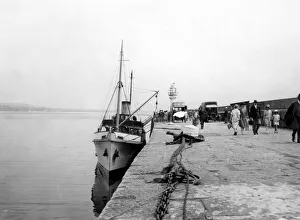
Scilly Isle Flower Traffic, Cornwall, August 1928A GWR publicity image taken on one of the Scilly Isles off the coast of Cornwall in August 1928, showing boats at the harbour loading flowers for shipping to the mainland
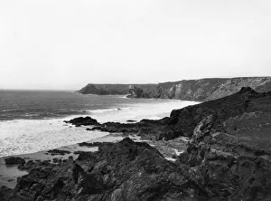
The Coastline Between Lizard and Kynance Cove, Cornwall, July 1924A GWR publicity view of the coast between Lizard and Kynance Cove in Cornwall, July 1924, showing the dramatic cliffs and rolling waves crashing onto rocks
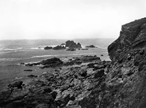
Between Lizard and Kynance Cove, Cornwall, July 1923A GWR publicity view of the coastline between Lizard & Kynance Cove in Cornwall, July 1923, showing the dramatic cliffs, rock formations and crashing waves
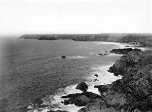
The Coast Between Lizard & Kynance Cove, Cornwall, July 1923A GWR publicity view of the coastline between Lizard & Kynance Cove in Cornwall, July 1923, showing the dramatic cliffs and crashing waves
Lizard Point, Cornwall, July 1923A GWR publicity view of Lizard Point in Cornwall, July 1923, showing the most southerly part of the UK and the old lifeboat station and its slipway
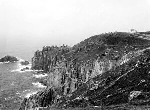
Lands End & The First and Last House, Cornwall, c. 1950A GWR publicity view of Lands End in Cornwall, taken from the south side near the First and Last House at the top of the cliff, c.1950
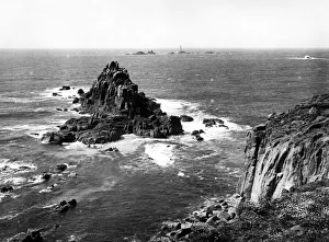
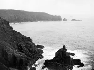
Lands End and Longships Lighthouse, Cornwall, c. 1950A GWR publicity view of Lands End and Longships Lighthouse, Cornwall. Taken on a sunny day c.1950 the lighthouse is clearly visible beyond the rugged rocks below the cliffs
Lands End, Cornwall, c. 1950A GWR publicity view of the southern side of Lands End in Cornwall, c.1950, showing the First and Last House and the rugged rocks below
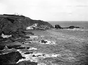
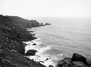
Lands End and Longships Lighthouse, Cornwall, c. 1928A GWR publicity view of the northern side of Lands End, Cornwall, c.1928, showing Longships Lighthouse in the distance
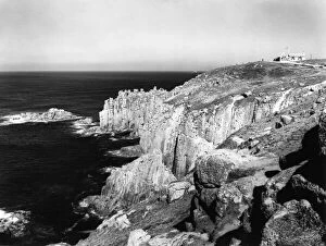
Lands End, Cornwall, c. 1928A GWR publicity view of the north side of Lands End, Cornwall, c.1928, showing the rugged coastal cliffs
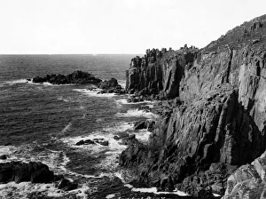
Cliffs at Lands End, Cornwall, 2nd February 1925A GWR publicity view of the cliffs below the First and Last House at Lands End, Cornwall, 2nd February 1925
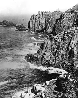
Cliffs at Lands End, Cornwall, 1924A GWR publicity view of the cliffs at Lands End in Cornwall, 1924. These cliffs lie below the First and Last House